Like clockwork, another Maine governor has put Sears Island at the center of industrial dreams. Which means it’s probably time to update the Beginner’s Guide. Until then, here’s an excerpt from The President’s Salmon – because you can’t talk about the river, the bay, without talking about the island.
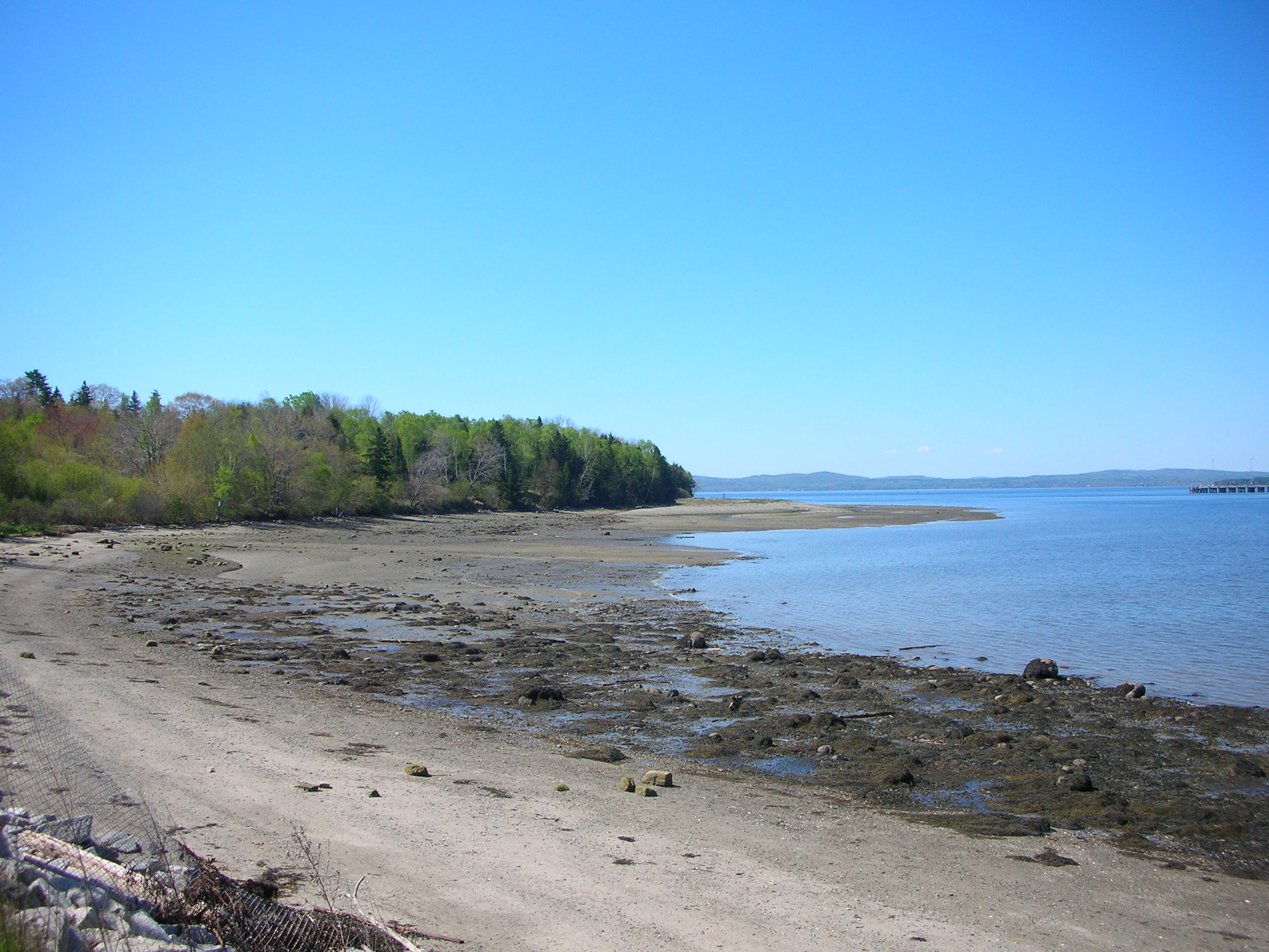
Remnants of wildness persist. Glades of knee-deep ferns conceal old stone walls and foundations. Deer trails vanish into alder thickets. Huge silver birches grace the meadows. Tides flood the salt marsh; waves flatten the stones of the beach. Harbor porpoise and seals arc and dive offshore. Gulls and osprey keen overhead.
At 941 acres, Sears Island is one of the largest uninhabited islands along the entire East Coast of the United States. The five miles of accessible shoreline are rare in Maine, where much of the waterfront is privately owned. Sears Island is one of few places to skip a rock across the water, find a piece of driftwood.
Yet the island is also nothing special. Its location is the primary reason for its notoriety. Bangor & Aroostook Railroad bought the island, and settlers left a few decades later in 1934. Over the next few decades, the island reverted to a wilder state; until 1969, when developers proposed the first of many intensive uses for the island: an aluminum smelter, an oil refinery, a nuclear power plant, a coal-fired power plant, a bulk cargo and container port for shipping potatoes, wood chips, and paper from the northern hinterlands.
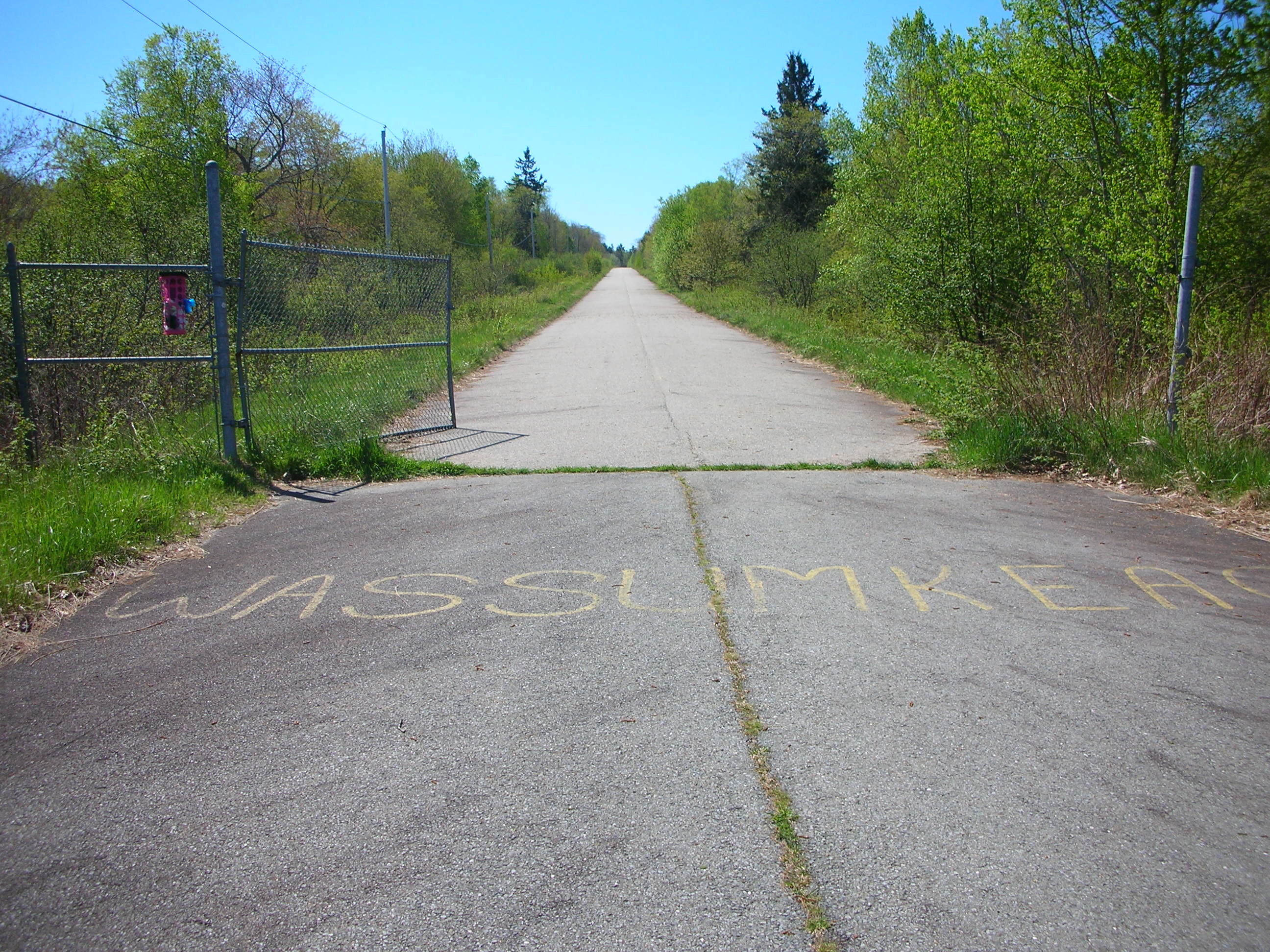
The latter effort advanced far enough to construct a long causeway along what had been a sand bar exposed at low tide, permanently connecting Sears Island to the mainland, and to pave a road up the spine of the island down to a rock jetty now overgrown with weeds.
Citizen protest, backed by legal action from the Sierra Club, twice blocked construction of the port. As with [the Basin Mills dam proposal], ever-stricter regulatory requirements from the U.S. Fish and Wildlife Service, the National Marine Fisheries Service, and the EPA revealed that the project was incompatible with fish, wildlife, and functional ecosystems. Angus King, now Governor of Maine, conceded another victory to environmentalists in February 1996, after spending more than fifteen years and around $20 million on the failed Sears Island port.
The environmental impact statements associated with the proposed port and other developments repeatedly cited Sears Island as being “not unique,” “not unusual,” “characteristic,” and “common.” Even scholars called the island “unremarkable.” Bisected with a road, its wetlands ruined, clam flats poisoned, electric wires strung through the forest to a radio tower that blinks in the night, Sears Island is no wilderness. Across the cove, the oil storage tanks and shipping terminal of Mack Point hum and clatter. But remnants of wildness persist.
In 2003, rumors of a proposed liquefied natural gas terminal on Sears Island drew attention to the island’s perpetual vulnerability. Governor John Baldacci, not wanting to repeat his predecessor’s experience with Sears Island, charged a group of municipal, state, and nonprofit interests with finding a compromise.[i]
[i] Among the interests with a stake in the outcome then were Protect Sears Island, Coastal Mountains Land Trust, Islesboro Island Trust, Friends of Sears Island, Penobscot Bay Alliance, Earth First!, Maine Tomorrow (led by the former commissioner of the Department of Transportation in the 1990s under Governor Angus King), Penobscot Bay River Pilots Association, Waldo County Marketing Association, Maine Pulp and Paper Association, Penobscot Bay Watch, Sierra Club, and Fair Play for Sears Island. A conservation easement now protects two-thirds of Sears Island, including nearly four miles of shoreline.
Did that compromise include the provision that already-industrialized Mack Point would be given preference over Sears Island by the state? Yes it did. So why in 2024 is the governor insisting on the island, instead of Mack Point, for realization of industrial wind-port dreams?